
HOW THE CABO VERDE ARCHIPELAGO FORMED
Let’s take a closer look to Sao Vincente
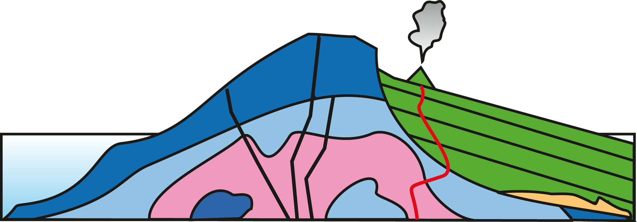
This is a simplified geological map of São Vicente: a Google Earth satellite image is overlain by the geological map. The major geological units found on São Vicente are shown. The colours refer to rocks units presented in the six development stages below (1-6).
Map and cartoons are redrawn after Ancochea, E., Huertas, M.J., Hernán F., Brändle J.L. (2010) Volcanic evolution of São Vicente, Cape Verde Islands: The Praia Grande landslide. Journal of Volcanology and Geothermal Research 198 pp. 143–157.
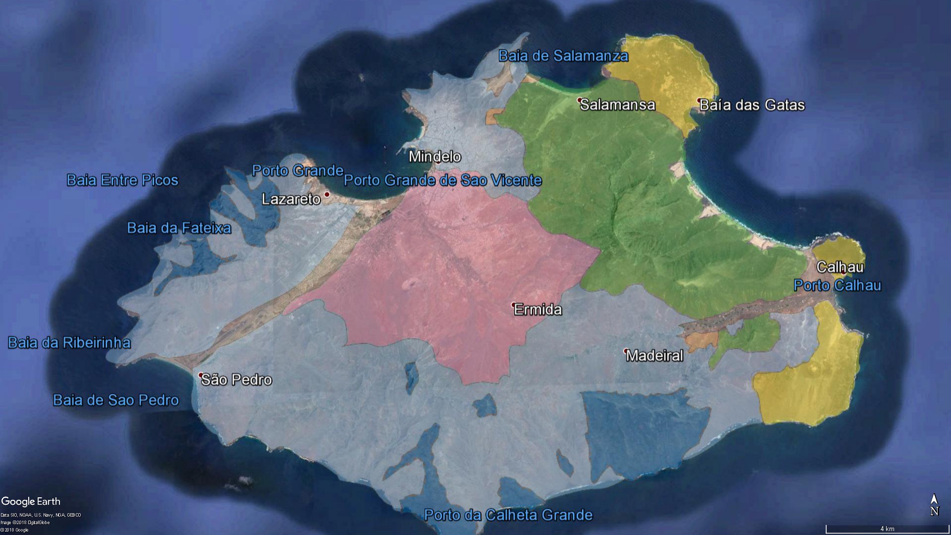
View from Monte Verde, São Vicente, towards São Pedro. Mindelo to the right. Overlay colours show the different geological units exposed from the different stages of island evolution.
The Evolution form Seamount to Ocean Island – the Example of São Vicente
More then 9 Ma

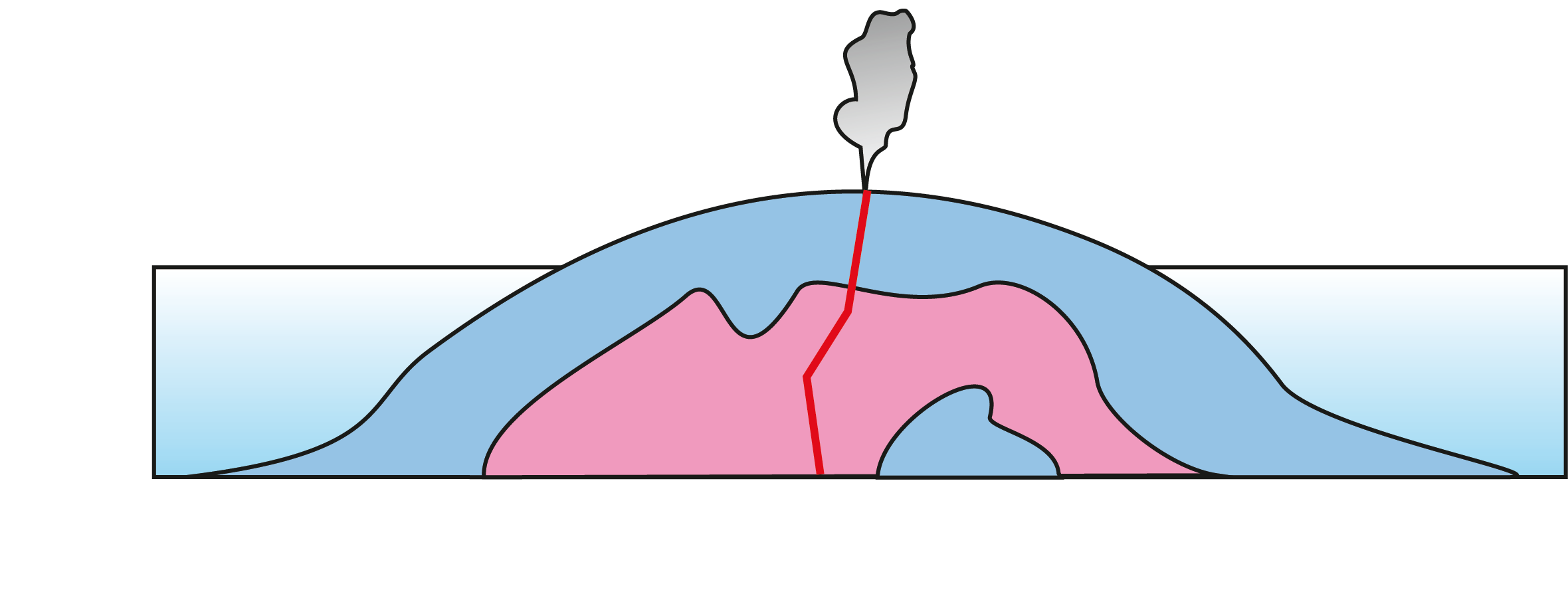
Stage 1: The Seamount Stage
Volcanism started at the seafloor and formed the base for the later island. The oldest unit on São Vicente can be found in the centre of the island. This part is probably older than
9 Ma (million years).
See project Oases of the Ocean for their influence on the life in the ocean.
6 – 5.5 Ma
Stage 2: Shield Stage
The Island emerged and formed a large shield volcano (Mindelo Formation). Traces of this formation can be found in the N, W and S of São Vicente. This phase began 6 million years ago and lasted 500.000 years.
See project Formation of Volcanic Island to get an impression how the rocks look for example in São Pedro.
5.5 – 4.5 Ma
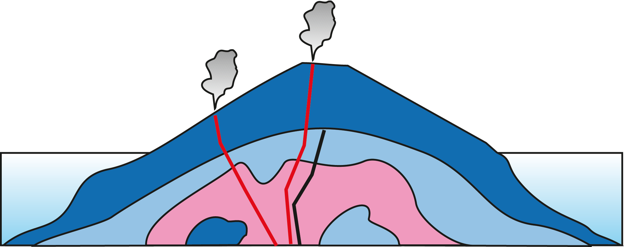
Stage 3: Shield Stage continued
The volcanism continued and formed a large volcano with layers dipping towards the sea: the Madeiral/Monte Cara formation. On top of Monte Cara you can see traces of this phase, and also on hills in the N, W, and S of São Vicente. This stage lasted about 1 million years (5.5 – 4.5 Ma).
Stage 4: Erosive Stage
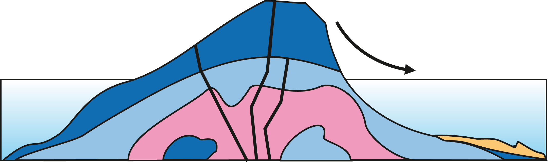
The volcano became instable and a large landslide occurred ~4.5 million years ago: the Praia Grande landslide. It displaced ~90 km3 of rocks and created a 12 km wide and 10 km long depression. On Fogo a similar landslide scar can be seen.
See project Falling apart for more information on landslides.
4 – 3 Ma
Stage 5: First Rejuvenation Stage
The landslide scar was filled with lava flows, dykes and pyroclastic rocks, all dipping towards the sea. The Monte Verde formation formed 3-4 million years ago. Today it forms the highest peak of São Vicente, 500-750 m above sea level.
Pico de Fogo on Fogo Island is a similar example for such a volcano.
0.3 – ? Ma
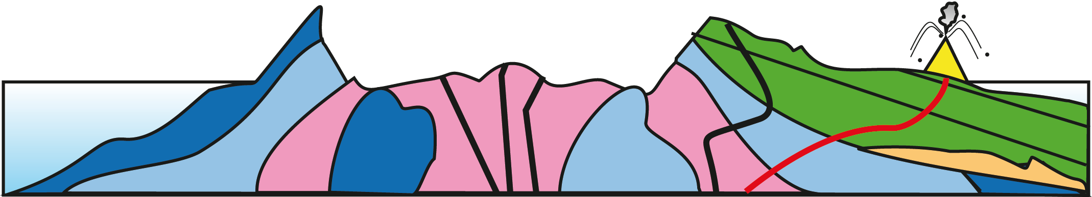
Stage 6: Second Rejuvenation Stage
Recent volcanism on São Vicente is very scarcely represented. It is limited to a small number of cinder cones in the NE and N of the island (e.g., close to Calhau). These cones also emitted lava flows to form new land. Erosion shaped the island and will continue to level the island.
See project Volcanoes and life on Cabo Verde for more information.
Lisa Samrock (HOSST), Eliezer Mendes (Uni CV), Subhadeep Rakshit (TOSST)